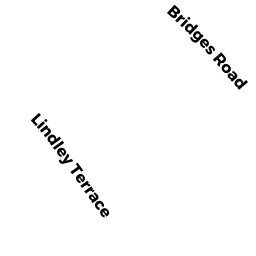
160 LINDLEY TERR
Owner Information
CANGELOSI, CHRISTOPHER H & SARAH E BRILL
160 LINDLEY TERRACE
WILLIAMSTOWN, MA 01267


Property Details
160 LINDLEY TERR is classified as a Single Family Residential (Colonial).
The primary structure on this property was built in 1970. There are 2,120ft2 of built area within this property. There is 2,120ft2 of residential/living space within this property. This property is listed as having 8 rooms.
160 LINDLEY TERR is valued at $333,600. The land is valued at $78,800 and the structures are valued at $254,100. There is an additional valuation of $700 on this property.
This property is in Zone GR. Confirm with local Zoning Board authorities to ensure there are no overlays or other easements on this property.
The most recent deed for 160 LINDLEY TERR is recorded at the local registrar in Book 1298, Page 1087. 160 LINDLEY TERR was last sold on Tuesday, July 10, 2007 for $350,000.
Assessment data from fiscal year 2022.
Flood Data
According to the FEMA National Flood Hazard Layer, this property does not appear to be in a flood zone. It may also be in an area not yet reviewed. Nonetheless, confirm this information prior to taking any action.
To view the flood hazards around this property, create a FEMA "Firmette" Map of the area around 160 LINDLEY TERR.
Broadband Internet Providers
| Provider | Type | Bandwidth (mbps) | |
|---|---|---|---|
| HughesNet | Satellite | 25 | 3 |
| Viasat Inc | Satellite | 35 | 3 |
| Verizon New England Inc. | DSL | 5 | 0 |
| Charter Communications Inc | Cable | 940 | 35 |
| GCI Communication Corp. | Satellite | 0 | 0 |
| VSAT Systems, LLC. | Satellite | 2 | 1 |
Broadband service provider data from December 2020.
Adjacent Properties
- 144 LINDLEY TERR
Single Family Residential owned by VOLASTRO ELISE T - 151 BRIDGES RD
Single Family Residential owned by SANDERS, DONALD H & ELMA B - 127 BRIDGES RD
Two-Family Residential owned by SLIZEWSKI, VINCENT J - 139 BRIDGES RD
Single Family Residential owned by NEATHAWK, RYAN & LINDSAY M JANECZ - 162 LINDLEY TERR
Single Family Residential owned by BERNHARDSSON, MAGNUS T & - 43 WHITE OAKS RD
Single Family Residential owned by DIBENEDETTO, ANTONELLO